The initial Live View concept that Google demoed at I/O 2018 saw the Maps application mark and overlay information over the real world. It was a more full-featured AR experience that was not limited to walking directions. Now two years old, Google is getting ready to fulfill that original vision.
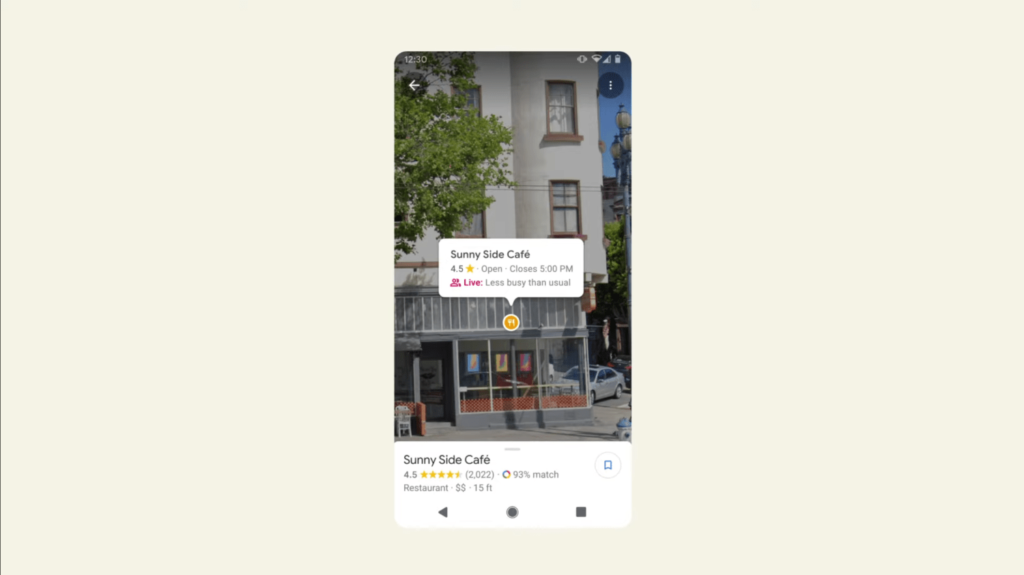
At the tail end of Search On 2020 today, Google said that it will provide “helpful information about a place right from within Live View.” The brief demo showed floating pins over locations that first identify what type of store or restaurant a place is. This description is followed by whether it’s open and when it closes.
Users can tap to see a star rating and whether it’s currently busy. A compact sheet slides up to open the standard listing. Google sells this capability as being able to get information by “simply pointing the camera.”
Those overlays build on Google Maps already showing AR-esque place markers in Street View. The tappable annotations identify the type of business — similar to the overhead maps — and let you “easily get more information about the places they’re exploring.” As we noted in June:
It surfaces information for street-level businesses so you can easily access phone numbers and photos. The functionality builds off annotations for museum artwork in 2017, and is rolling out to Google Maps for Android and the web.
That was clearly laying the groundwork for Live View, with this feature arriving “in the coming months.”
I/O 2018
At the start of October, Google announced how the feature would overlay nearby landmarks to help AR navigation, while Live View can be used to calibrate your current location and orientation. There’s also now location sharing where you use Live View to find friends instead of places. It can also be accessed without starting the full navigation mode for quicker interactions.