


State geologists studying the landslide risks at the Rattlesnake Ridge area estimate an “event” will occur between January 14 and February 28.
State geologists studying the landslide risks at the Rattlesnake Ridge area in Yakima County estimate an “event” could occur as early as next Sunday.
“Based on monitoring data, geologists and engineers who are studying the landslide estimate an event will occur sometime between January 14 and February 28, 2018,” the Yakima Valley Office of Emergency Management posted on Facebook Sunday.
“What’s going to happen and when? The honest answer is no one knows for certain. There are a number of possibilities.”
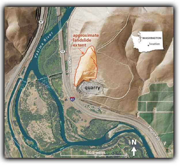
Geologists with the Washington Department of Natural Resources say according to data, the most likely scenario is that the landslide will continue to move slowly south, where it will fall into a quarry pit and accumulate.
Some rocks are expected to fall and reach nearby Thorp Road, but not I-82 or the Yakima River.
They say “less likely scenarios” are that the landslide moves beyond the quarry and damage houses or run out beyond I-82. “A landslide that moves west and blocks I-82 and the Yakima River is extremely unlikely.”
Inslee visits Rattlesnake Ridge
Governor Jay Inslee visited the Rattlesnake Ridge area on Sunday to assess the area and meet with local emergency management officials.
“The multiple geologists that have reviewed this all have the same conclusion at the moment. And that is, the risk of catastrophic sliding activity that could pose a danger to life is a low risk,” said Inslee. “Nonetheless, if that were to happen – even though it’s a low risk – the nature of the slide could be very concerning to people, both for residents and for people transiting I-82.”
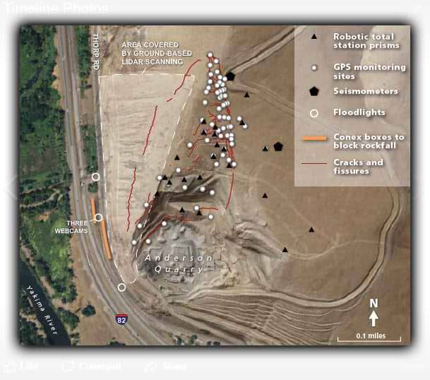
Several geologists with multiple state agencies have surveyed the area and provided the preliminary data. Dozens of data collection points have been set up around the slide, providing geologists with data needed to monitor the movement of the land and its risk.
Inslee said experts are evaluating whether to have additional monitoring or analysis of the area.
“In the next several days, we will be probably engaging a third party, independent consultant that would work for the state of Washington for the multiple agencies involved,” said Inslee. “We want to do that to make sure that we have the ultimate degree of confidence in assessing the nature of this risk.”
Over 50 local, state and federal agencies are working together on the incident, according to Yakima Valley Office of Emergency Management.
More people were packing up and evacuating Friday night because of landslide concerns.
Tomas Guzman brought his truck to a friend’s home, just off Thorp Road. They worked for four hours to pack up the family of three, and get away from the Rattlesnake Ridge area.
“We don’t want to wait until the last minute,” said Guzman.
Yakima County Office of Emergency Management has urged about 50 people living near Thorp Road to evacuate, and so far more than 80 percent have left.
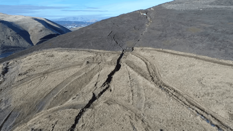
By now, many in the community have seen the aerial video that shows a long crack in Rattlesnake Ridge. The movement was first noticed in October.
Meagan Lott, a WSDOT spokesperson says the land is sliding 1.4 feet each week.
Yakima County Office of Emergency Management estimates that 8 million tons of earth could slide within the month.
Lott said when it comes to a landslide, “It is not a matter of if but when.” She added that there is a best-case scenario.
“What we are being told is the material above Thorp Road will most likely go into the pit site below and kind of stabilize itself out,” she said.
But Lott acknowledged it is possible the landslide could move toward homes and Interstate 82. Freight containers loaded with concrete barriers are set up along Thorp Road. WSDOT says it would not stop a landslide. However, the chain of containers is being used to block falling rocks and debris from I-82.
“This morning we had a rock come down and land on to Thorp Road which is the county road that is currently closed right now, and it was the size of a baseball,” said Lott.
If activity picks up and more rocks start to fall, WSDOT could close I-82. On a typical day, about 30,000 vehicles travel the stretch of Interstate near Thorp Road. If it does have to close, WSDOT says drivers would have a 15-mile detour.


